Land Surveying
LAND SURVEYING METHODS
Using the latest Land Surveying equipment paired with experience allows us to record all of the required information for your project with extreme precision. We’ve regularly survey everything from paved parking lots of the bay area to rugged timber covered mountains of Northern California. We provide topographic and boundary survey services to Marin County and the entire Bay area, With decades of experience dealing with complicated boundary issues and determining the need for a Record of Survey. We provide an honest and legal opinion on project scope and avoid adding on costs down the road. We stay in contact and regularly refer to the local ordinances and policies so that we can minimize unexpected project expenses and cost. We offer specialty aerial LIDAR surveying and modeling as well. We provide land surveying services across the entire bay area and are based out of Marin County.
AERIAL AND GROUND BASED LIDAR SURVEYING
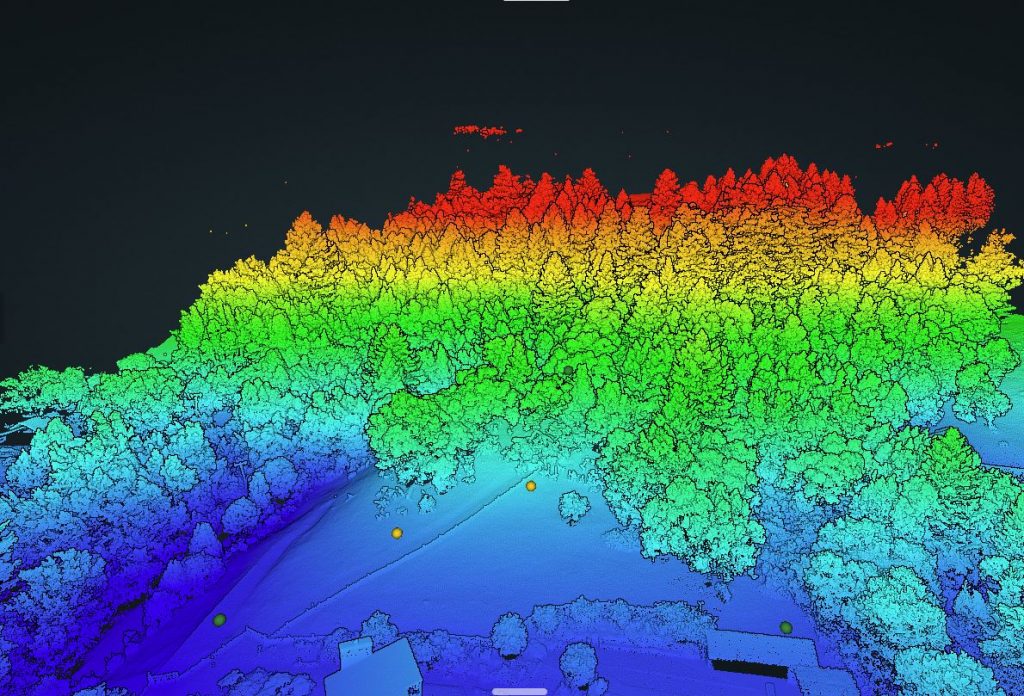
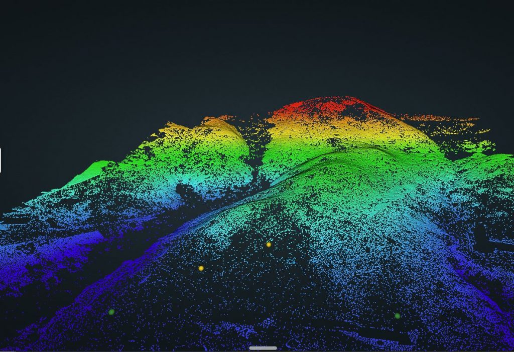
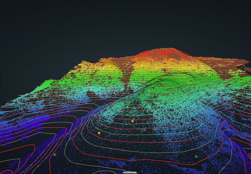
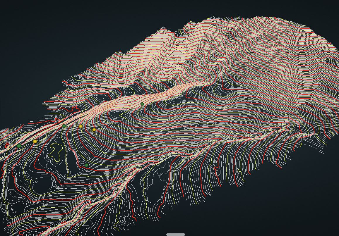
Using LIDAR (light detection and ranging) technology we are able to make extremely precise 3d models of terrain and structures that would be nearly impossible to survey using traditional methods. Our LIDAR equipment has a very high accuracy of ±0.09′, allowing us to accurately survey extremely large parcels of land ranging thousands of acres or be able to scan a small single house with ease. If you need to survey a large amount of land in Marin county or anywhere in Northern California, we are capable of doing so at a fraction of the cost of traditional surveying with far more accuracy and precision. LIDAR can penetrate through extremely dense forest canopies and thick underbrush to extract information that would be otherwise expensive and time consuming to collect via optical or GPS collection methods. We have both Aerial Drone Equipment as well as hand held LIDAR equipment allowing us to scan building interiors and more technical areas that the Drone may not be able to access. We are able to provide precise 3D and 2D models of all types terrain, buildings, bridges, power lines and more.
GPS (GLOBAL POSITION SYTEM)
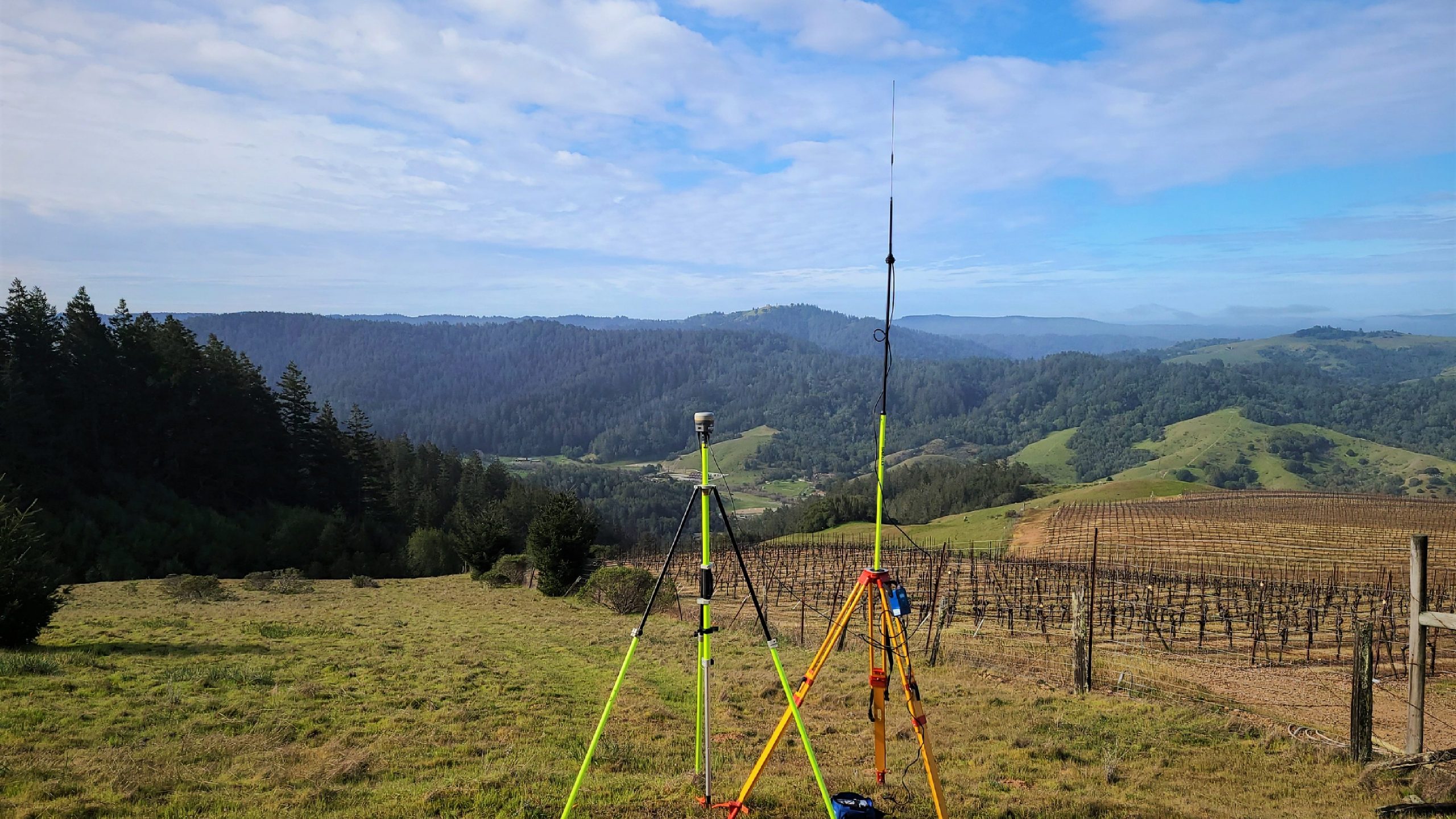
We have various GPS devises with specialized radios allowing our GPS receivers to operate within a 15 mile range allowing us to survey rugged and rural terrain . GPS is critical to be able to survey the rural farmlands of west Marin and Sonoma county, with little to no existing monumentation near by. Our primary use of the GPS is to collect boundary data from neighboring properties to connect property line to the neighboring maps. In rural lands it is often difficult for traditional optical equipment to be used and requires miles of dense underbrush to be cleared. Our GPS systems provide accuracy to ±0.04′ with the only requirement being a semi clear view of the sky to ensure your property lines are measured exactly where they need to be.
Robotic Total Station (Optical)
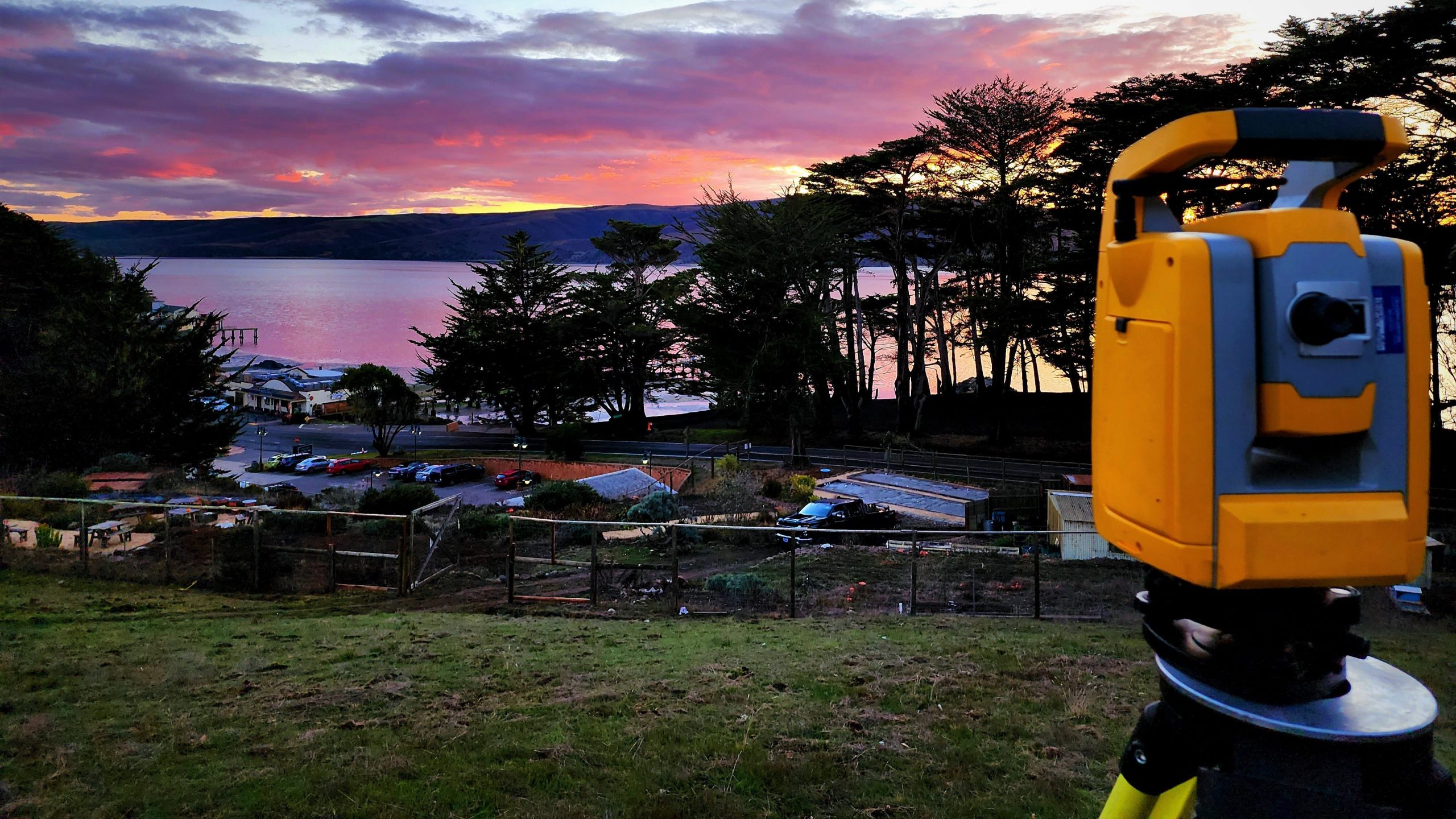
Robotic Total Stations are not new to the land survey field, but remain as one of the most critical elements for urban surveying. They operate using lasers and require a clear line of sight to ensure a proper recording of a point. Total Stations operate fast so shooting several hundred points per day with extreme accuracy ( ±0.01′) can be achieved. We use our total station for anywhere that requires extremely high accuracy and precision such as hardscape, ADA ramps, construction staking and constrained areas. Often our more technical surveys require the use of LIDAR, GPS and Total Stations to provide the most thorough product to the client possible.
Our Typical Land Surveying Projects Include
- Topographic Surveys
- Boundary Surveys
- Record Of Surveys (Please see the Record of Survey Page)
- Legal Descriptions
- Lot Line Adjustments
- Easement Plats and Exhibits
- Tentative Maps
- Subdivision Mapping
- Elevation Certificate Surveys
- Fema Flood Certifications
- Construction Staking
- ALTA Surveys
